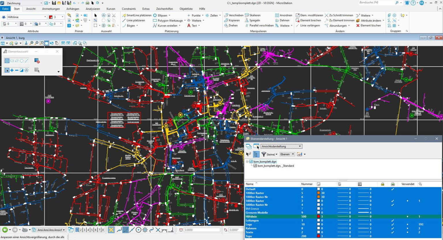
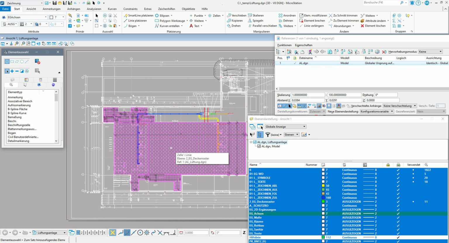
Our range of services includes the use of geographic information systems (GIS) and automated real estate maps (ALK), which are used for the schematic representation of line networks and electronic switching, circuit and wiring diagrams.
Our drawing office team also creates digital drawings and plans for a wide range of tasks, such as fire and alarm plans, topographical maps and schematic low-voltage network plans (LVN).
In addition, our CAD department offers numerous design services and provides you with printing, plotting and scanning services.
In addition, our specialized departments offer a wide range of other services, such as
Coordinate-accurate overview plans of pipeline networks on a topographical basis
Routing work
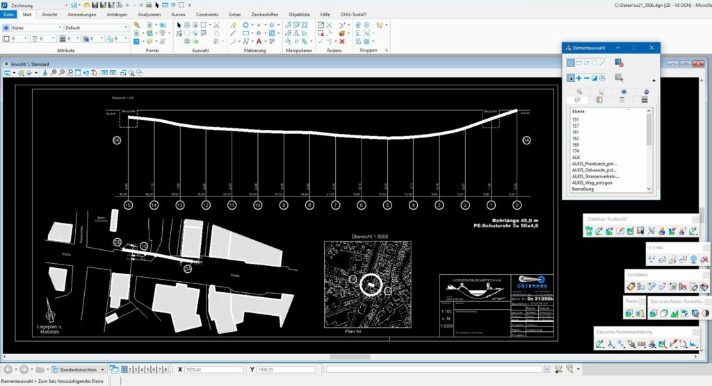
Graphic horizontal drilling logs
Archiving work
Our competent staff implement your ideas through careful project planning and realize your desired concept. Constant technical innovations, staff training and the associated progressive integration of practical experience and technical “know-how” guarantee efficient implementation of the latest scientific and technical findings.